Atacama
Desert & Altiplano, Chile
Explorations in
Atacama
Activity
Difficulty
Areas
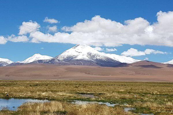
Vilama
Cuenca del salar

-
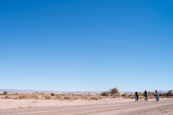
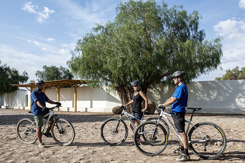
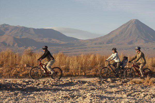
 E-Bike
 -
Expert
-
Half-day
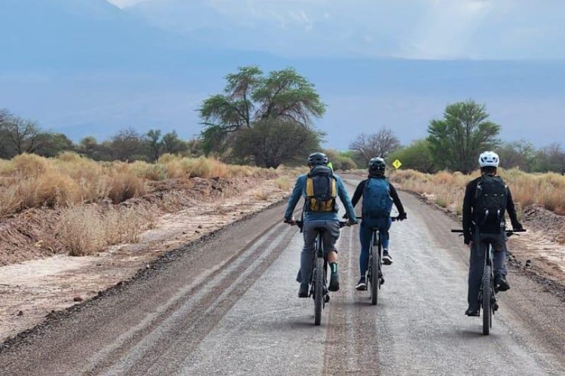
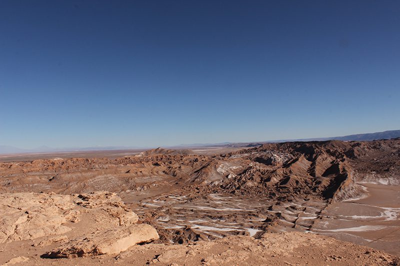
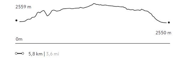
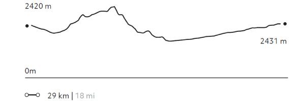
This exploration leads to the Vilama Pukara viewpoint, where you'll uncover the remains of a Likan Antay fortress, once vital for safeguarding fertile lands and the river delta of the Vilama River
More details >Vilama


-
Exploration Path
This exploration leads to the Vilama Pukara viewpoint, where you'll uncover the remains of a Likan Antay fortress, once vital for safeguarding fertile lands and the river delta of the Vilama River—offering a glimpse into the region’s ancient defensive strategies.
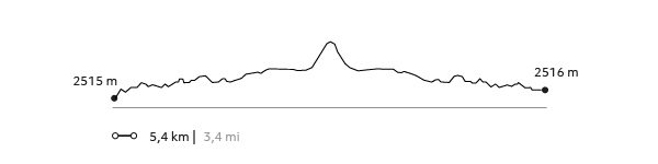
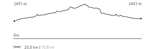
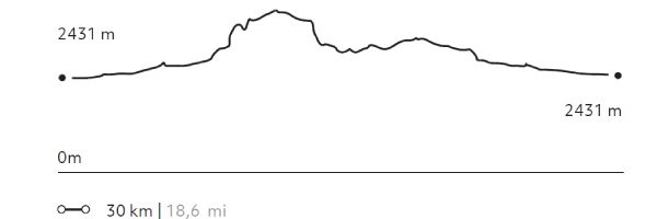
822 m 2.697 ft
-822 m -2.697 ft
2.727 m 8.947 ft
2.430 m 7.972 ftElevation Profile
Oasis
Cuenca del salar
-
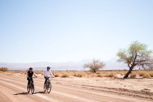
E-Bike
-
Easy
-
Half-day
The Oasis E-bike exploration uncovers the ancient settlements of the Licanantay culture in the Atacama Desert.
More details >Oasis

-
Exploration Path
The Oasis E-bike exploration uncovers the ancient settlements of the Licanantay culture in the Atacama Desert. Discover sites like the Tulor settlement in the Ayllu de Coyo, the Puribeter Elemental Reserve, and the Desert Library, blending history, nature, and local culture.
146 m 479 ft
-145 m -476 ft
2431 m 7976 ft
2376 m 7795 ftElevation Profile
Cejar
Cuenca del salar
-
Overland
-
Easy
-
Half-day
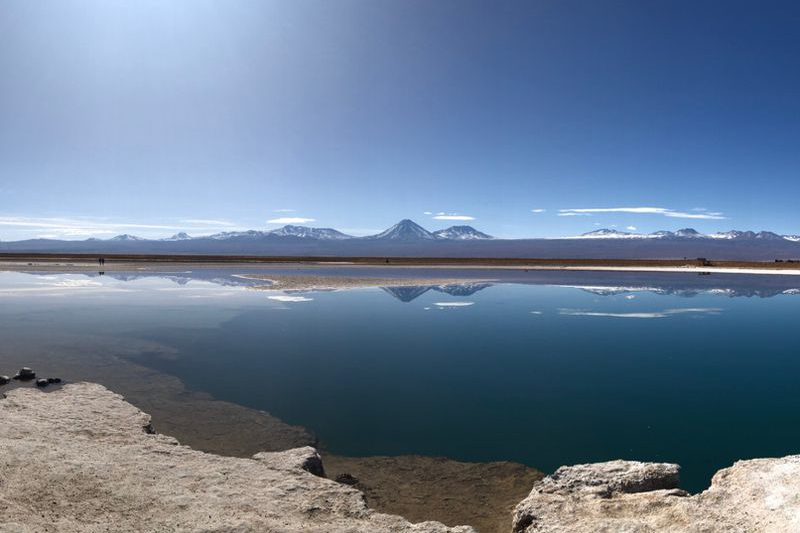
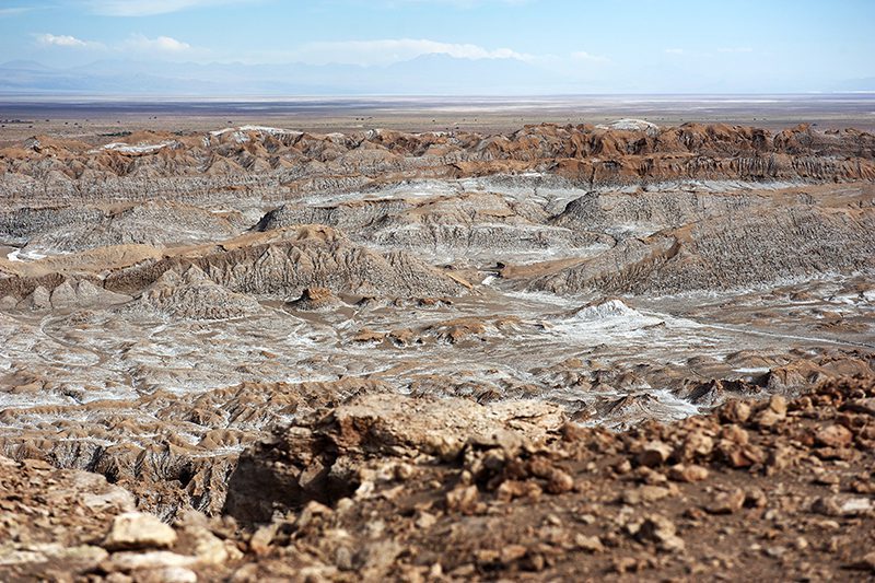
The Atacama Salt Flat is an endorheic basin with highly saline water outcrops, one of which is the Cejar Lagoon. We will venture into the northern part of the salt flat, surrounded by the vastness and accompanied by the Andean volcanoes. Once at Cejar, we will be able to enter its waters and float in the middle of the driest desert in the world.
More details >Cejar

-
Exploration Path
The Atacama Salt Flat is an endorheic basin with highly saline water outcrops, one of which is the Cejar Lagoon. We will venture into the northern part of the salt flat, surrounded by the vastness and accompanied by the Andean volcanoes. Once at Cejar, we will be able to enter its waters and float in the middle of the driest desert in the world.
Camino del agua
Cuenca del salar
-
Hike
-
Easy
-
Half-day
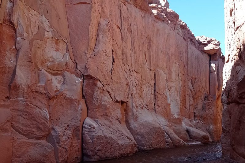
We will travel into the interior of the desert where nature and history blend. We will walk inside an incredible and gigantic canyon, an arm eroded by the water of the San Pedro River that flows within it. We will arrive at a sector with a great quantity of petroglyphs, as the place was a refuge for caravans. For most of the hike, we will be walking through water. *It is recommended to bring two pairs of shoes.
More details >Camino del agua

-
Exploration Path
We will travel into the interior of the desert where nature and history blend. We will walk inside an incredible and gigantic canyon, an arm eroded by the water of the San Pedro River that flows within it. We will arrive at a sector with a great quantity of petroglyphs, as the place was a refuge for caravans. For most of the hike, we will be walking through water.
*It is recommended to bring two pairs of shoes.
Quebrada de Chulacao
Cuenca del salar
-
Hike
-
Easy
-
Half-day
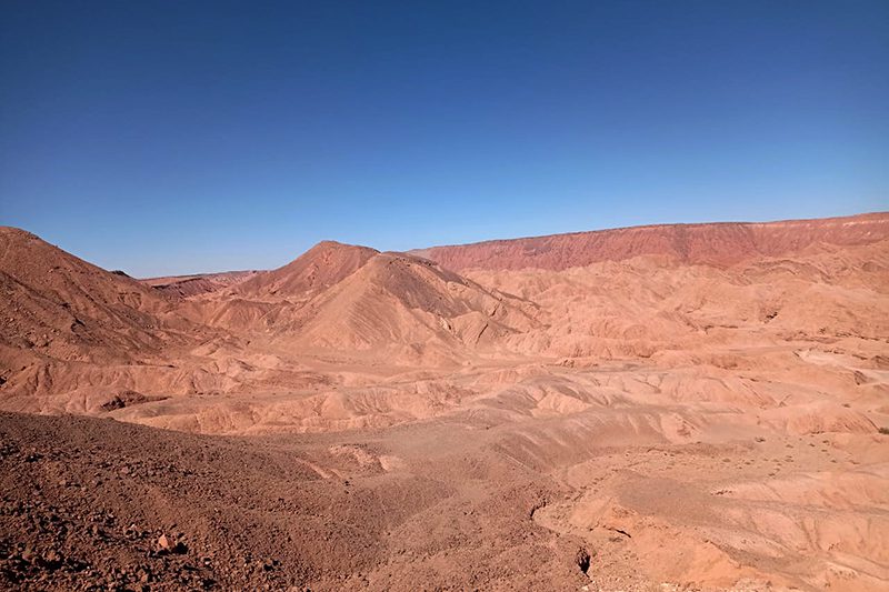
At the foot of the Salt mountains, we come to the Catarpe Valley, which receives the San Pedro river that feeds the oasis and the salt marsh. In the valley, we will begin our hike in the Quebrada Chulaco, a great canyon with high walls, with curves and serpentine shapes formed by moldable minerals and water erosion. Upon leaving the canyon we will hike up to a viewpoint with 360° views of the desert and its mountain ranges. We return along the same trail.
More details >Quebrada de Chulacao
-
Exploration Path
At the foot of the Salt mountains, we come to the Catarpe Valley, which receives the San Pedro river that feeds the oasis and the salt marsh. In the valley, we will begin our hike in the Quebrada Chulaco, a great canyon with high walls, with curves and serpentine shapes formed by moldable minerals and water erosion. Upon leaving the canyon we will hike up to a viewpoint with 360° views of the desert and its mountain ranges. We return along the same trail.
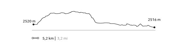
156 m 512 ft
-156 m -512 ft
2.582 m 8.471 ft
2.515 m 8.251 ftElevation Profile
Caravaneros
Cuenca del salar
-
Hike
-
Easy
-
Half-day
This hike is a journey through the history of the old caravans and their interaction with the desert. We will cross from the Vilama sector toward the Catarpe Valley along old desert trails until reaching the great canyons in Quebrada Chulaco. This hike gives us broad 360° views that will allow us to understand the desert's different areas and formations.
More details >Caravaneros
-
Exploration Path
This hike is a journey through the history of the old caravans and their interaction with the desert. We will cross from the Vilama sector toward the Catarpe Valley along old desert trails until reaching the great canyons in Quebrada Chulaco. This hike gives us broad 360° views that will allow us to understand the desert's different areas and formations.
159 m 522 ft
-183 m -600 ft
1617 m 5304 ft
2515 m 8249 ftElevation Profile
San Isidro
Cuenca del salar
-
E-Bike
-
Moderate
-
Half-day
We ride our bicycles to the Catarpe Valley in the Salt Ridge. We pedal through switch paths between canyons...
More details >San Isidro

-
Exploration Path
We ride our bicycles to the Catarpe Valley in the Salt Ridge. We pedal through switch paths between canyons made of reddish soil in a place known as Garganta del Diablo (Devil’s Throat). We visit the San Isidro church into a historic area.
325 m 1.066 ft
-325 m -1.066 ft
2.584 m 8.478 ft
2.431 m 7.976 ftElevation Profile
Cordillera de la Sal
Cuenca del salar
-
Overland
-
Easy
-
Half-day
We take a van to the Salt Mountain Range to see typical desert landscapes: open reddish clay grounds, sand dunes...
More details >Cordillera de la Sal
-
Exploration Path
We take a van to the Salt Mountain Range to see typical desert landscapes: open reddish clay grounds, sand dunes, and sedimentary rock formations. We walk up to the highest point of this mountain range to see the panoramic views. We will take a 30 minute walk through one the least known mountainsides of the Salt Ridge.
Gran Salar
Cuenca del salar
-
Overland
-
Easy
-
Half-day
We leave in a van to Toconao, located to the south of San Pedro de Atacama. We walk to the village square and then through an area...
More details >Gran Salar
-
Exploration Path
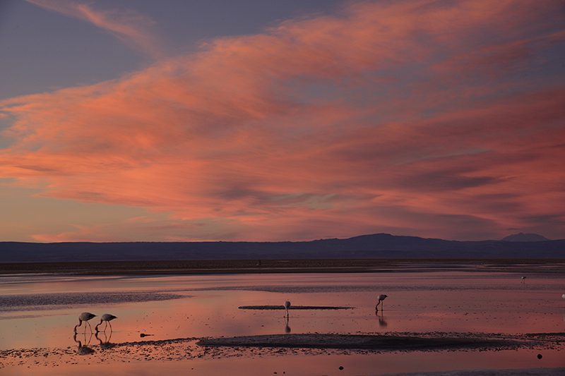
We leave in a van to Toconao, located to the south of San Pedro de Atacama. We walk to the village square and then through an area of vegetable gardens. We finally take a van to the Chaxa Lagoon, located in the Los Flamencos National Reserve, an ideal place for bird watching within Atacama’s Salt Flat.
Kunza
Cuenca del salar
-
Overland
-
Easy
-
Half-day
In this exploration we learn about the Atacameño history and culture. We start with a guided tour of an archaeological deposit...
More details >Kunza
-
Exploration Path
In this exploration we learn about the Atacameño history and culture. We start with a guided tour of an archaeological deposit where we can see ceramic pieces and other historical artifacts fit for a museum. Later on, we move on to the village of Tulor, one of the first settlements. We end the exploration at the mythical desert bookstore.
Tambo
Cuenca del salar
-
E-Bike
-
Advanced
-
Half-day
We bike ride to the Catarpe Valley. We ride up to Cuchabrache, through an old road that crosses the Salt Mountain Range...
More details >Tambo

-
Exploration Path
We bike ride to the Catarpe Valley. We ride up to Cuchabrache, through an old road that crosses the Salt Mountain Range. We ride through plaster and crystallized salt creeks. This exploration includes seeing part of the local culture and petroglyphs, as well as the San Isidro church.
*Temporarily unavailable. Consult other exploration options with your Explora guide at the destination.
568 m 1.864 ft
-568 m -1.864 ft
2.690 m 8.825 ft
2.431 m 7.976 ftElevation Profile
Cuchabrache
Cuenca del salar
-
Hike
-
Moderate
-
Half-day
We take a van up to the Catarpe Valley, where we begin ascending the Salt Mountain Range. On the way, we’ll see petroglyphs...
More details >Cuchabrache
-
Exploration Path
We take a van up to the Catarpe Valley, where we begin ascending the Salt Mountain Range. On the way, we’ll see petroglyphs and from the top, we can admire the green valley landscapes contrasting with the colors of Salt and Andes Mountain Ranges. This is an ideal introduction to the Atacama region. We return by van.
*Temporarily unavailable. Consult other exploration options with your Explora guide at the destination.
348 m 1.142 ft
-322 m -1056 ft
2.693 m 8.835 ft
2.504 m 8.215 ftElevation Profile
Catarpe
Cuenca del salar
-
Bike
-
Easy
-
Half-day
We bike ride to the San Pedro River and follow its course to Catarpe. We go through the Quitor pukará...
More details >Catarpe
-
Exploration Path
We bike ride to the San Pedro River and follow its course to Catarpe. We go through the Quitor pukará, an old fortress, and cross the Garganta del Diablo (Devil’s Throat), a canyon inside the Salt Mountain Range with zigzagging paths between striking rock formations. We return through the same road.
244 m 801 ft
-244 m -801 ft
2.546 m 8.353 ft
2.431 m 7.976 ftElevation Profile
Ckuta
Cuenca del salar
-
E-Bike
-
Easy
-
Half-day
We take a van to the Salt Mountain Range and begin bike riding in the Paciencia plains. We travel to the Moon Valley through...
More details >Ckuta
-
Exploration Path
We take a van to the Salt Mountain Range and begin bike riding in the Paciencia plains. We travel to the Moon Valley through sandy soil and beautiful landscapes. The return trip is an uneven path that includes different ascents and descents.
251 m 823 ft
-240 m -787 ft
2.488 m 8.163 ft
2.366 m 7.762 ftElevation Profile
Piedra de la Coca
Cuenca del salar
-
E-Bike
-
Moderate
-
Half-day
We leave by bicycle to Catarpe through a road that goes up to the Salt Mountain Range. We go through an ancient tunnel...
More details >Piedra de la Coca
-
Exploration Path
We leave by bicycle to Catarpe through a road that goes up to the Salt Mountain Range. We go through an ancient tunnel before starting a descent that will take us to the Piedra de la Coca, a site with petroglyphs. We continue our trip to the Paciencia plains through stony grounds and on our way back we pass through the Mars Valley.
560 m 1836,8 ft
-560 m -1837 ft
2.642 m 8.666 ft
2.431 m 7.974 ftElevation Profile
-
Other options: