Torres del Paine
Patagonia, Chile
Explorations in
Torres del Paine
Activity
Difficulty
Areas
La Pampa
Conservation Reserve
-
 Hike
Hike -
Moderate
-
Half-day
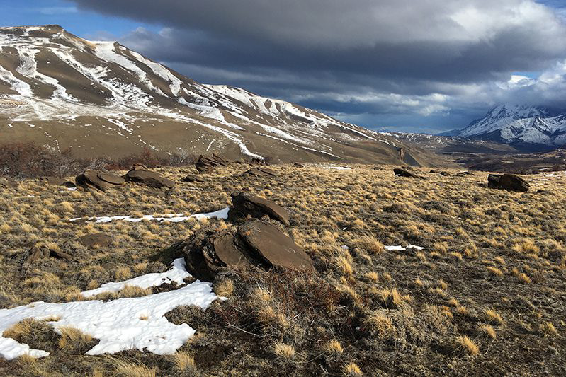
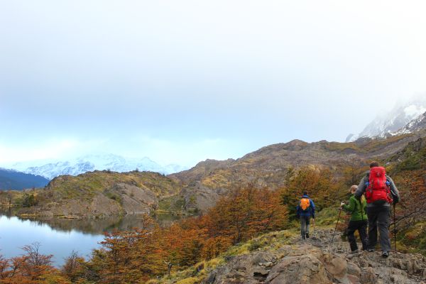
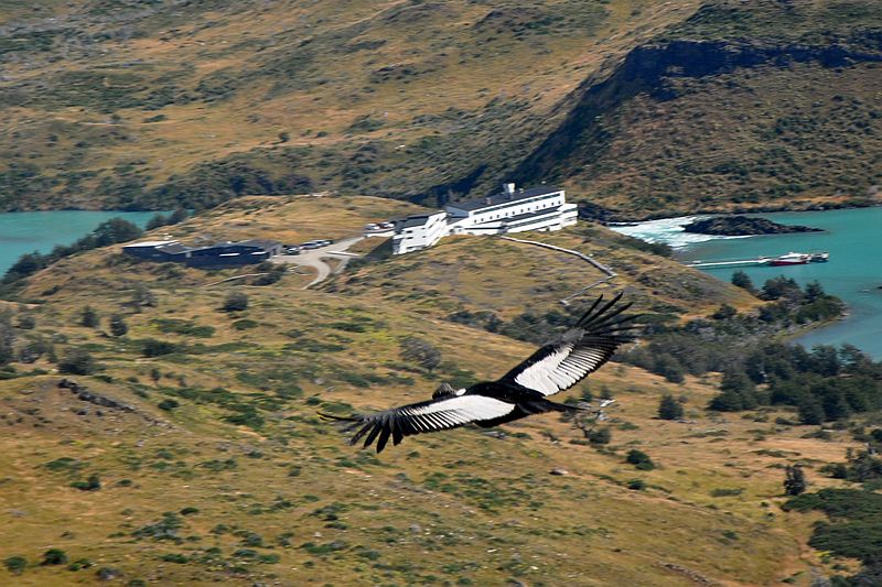
We hike across the steppe of the reserve, surrounded by mountains, steppe and valleys. Aloong the way, you will be able to enjoy views of the Paine range, Cerro Obelisco, Laguna Jara and Sierra Baguales. The local flora is rich in coirón, matabarrosa and ñirre, while the fauna includes guanacos, pumas, chingues, caranchyos, condors and flamingoes, among others. In this area you can see the history of the occupation of the province of Última Esperanza, due to the old estate that was here. You will also learn about the history of Lady Florence Dixie, the first woman explorer in Patagonia.
More details >La Pampa


-
Exploration Path
We hike across the steppe of the reserve, surrounded by mountains, steppe and valleys. Aloong the way, you will be able to enjoy views of the Paine range, Cerro Obelisco, Laguna Jara and Sierra Baguales. The local flora is rich in coirón, matabarrosa and ñirre, while the fauna includes guanacos, pumas, chingues, caranchyos, condors and flamingoes, among others.
In this area you can see the history of the occupation of the province of Última Esperanza, due to the old estate that was here. You will also learn about the history of Lady Florence Dixie, the first woman explorer in Patagonia.
Río Zamora
Conservation Reserve

-
Hike
-
Easy
-
Half-day
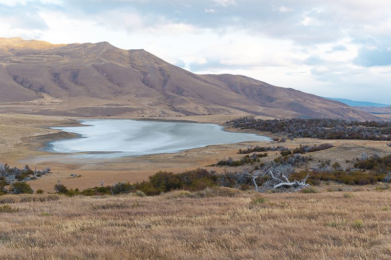
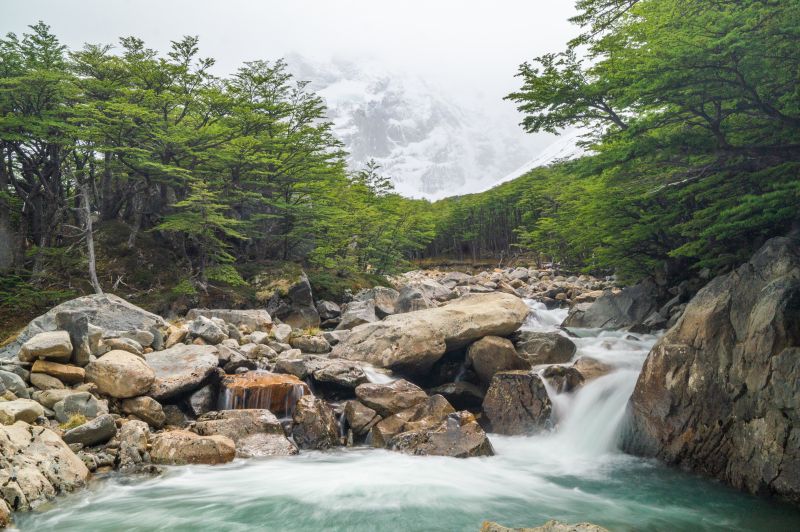
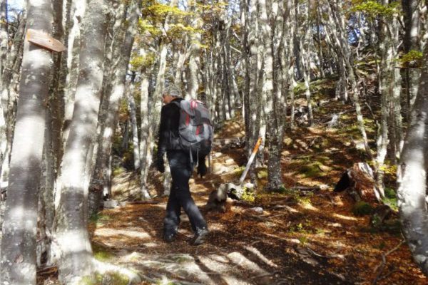
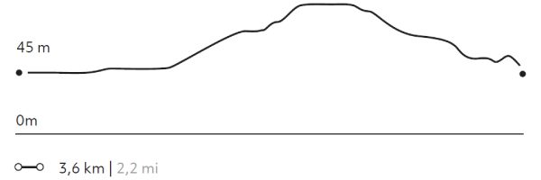
We walked through the western sector of the Torres del Paine Conservation Reserve, with views of the Zamora Canyon and river, passing through Magellanic forests and rock monoliths. Throughout the journey, one can admire views of the impressive "V"-shaped canyon of the Zamora River and the Paine mountain range, including the Obelisco Hill. The local flora is rich in coiron, matabarrosa, lenga, mataguanacos, and nirre, while the fauna includes guanacos, pumas, chingues, caranchos, condors, bandurria, chuncho, among others.
More details >Río Zamora

-
Exploration Path
We walked through the western sector of the Torres del Paine Conservation Reserve, with views of the Zamora Canyon and river, passing through Magellanic forests and rock monoliths. Throughout the journey, one can admire views of the impressive "V"-shaped canyon of the Zamora River and the Paine mountain range, including the Obelisco Hill. The local flora is rich in coiron, matabarrosa, lenga, mataguanacos, and nirre, while the fauna includes guanacos, pumas, chingues, caranchos, condors, bandurria, chuncho, among others.
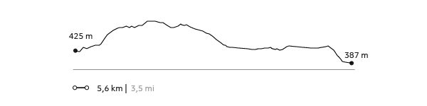
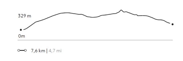
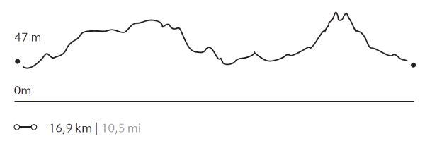
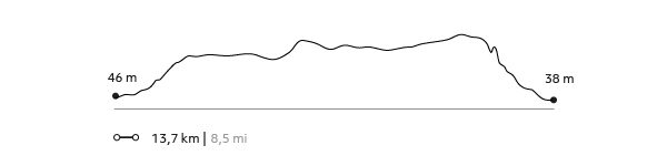
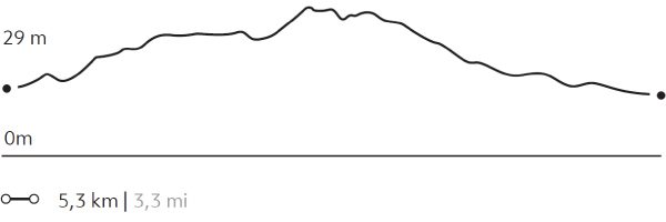
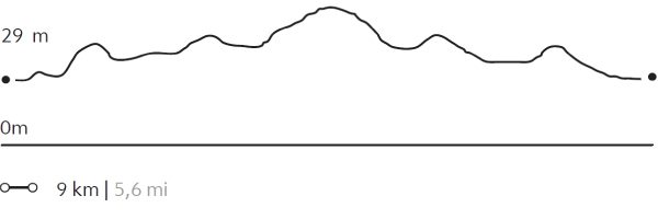
157 m 515 ft
-126 m -413 ft
489 m 1.604 ft
371 m 1.217 ftElevation Profile

Los Bosques
Conservation Reserve
-
Hike
-
Easy
-
Half-day
We will walk through the Laguna Jara sector and see different landscapes, such as La Vega (wetland), steppes, forests, mountains and valleys. As we tour this territory, we will be able to observe different flora and fauna like coirón, matabarrosa, ñirres, guanacos, pumas, chingues and flamingos, among others.
More details >Los Bosques
-
Exploration Path
We will walk through the Laguna Jara sector and see different landscapes, such as La Vega (wetland), steppes, forests, mountains and valleys. As we tour this territory, we will be able to observe different flora and fauna like coirón, matabarrosa, ñirres, guanacos, pumas, chingues and flamingos, among others.
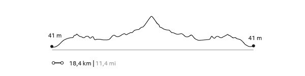
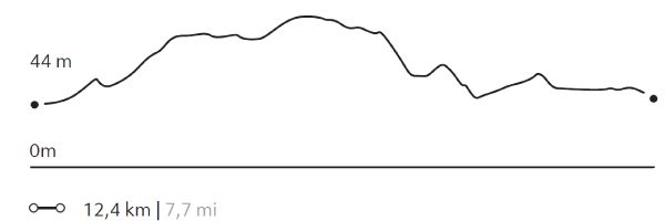
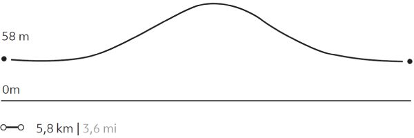
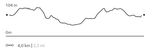
110 m 361 ft
-141 m -463 ft
489 m 1.604 ft
387 m 1.270 ftElevation Profile
AONIKENK
Estepa
-
Hike
-
Moderate
-
Half-day
We travel by van to the eastern sector of the park, where we hike, exploring the wildlife. During the walk, we visit a cave...
More details >AONIKENK
-
Exploration Path
We travel by van to the eastern sector of the park, where we hike, exploring the wildlife. During the walk, we visit a cave with paintings that are over 4,000 years old. We can observe the geese, ducks and swans in the lagoons that are on the way. The terrain has various ascents and descents without steep slopes. Return by van.
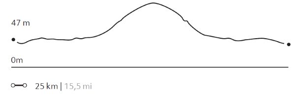
303 m 994 ft
-237 m -778 ft
329 m 1.079 ft
95 m 312 ftElevation Profile
CAMPAMENTO BRITANICO
Glaciar
-
Hike
-
Expert
-
Full-day
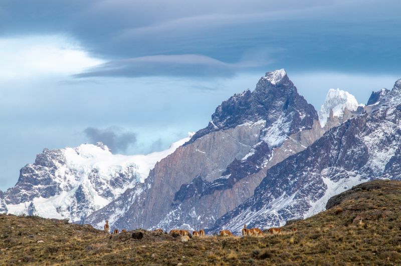
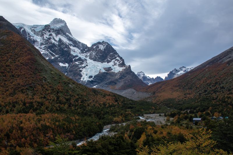
This exploration takes us along one section of the W. circuit. We cross Lake Pehoé by catamaran to the Paine Grande shelter, where we will begin our hike to Valle del Francés. We cross lenga forests to the Mirador Británico, a place with 360° views of the natural amphitheater formed by the Horns and imposing rock formations such as the Shark’s Fin and the Fortress.
More details >CAMPAMENTO BRITANICO

-
Exploration Path
This exploration takes us along one section of the W. circuit. We cross Lake Pehoé by catamaran to the Paine Grande shelter, where we will begin our hike to Valle del Francés. We cross lenga forests to the Mirador Británico, a place with 360° views of the natural amphitheater formed by the Horns and imposing rock formations such as the Shark’s Fin and the Fortress.
1.192 m 3.911 ft
-1.192 m -3.911 ft
712 m 2.336 ft
39 m 128 ftElevation Profile
GUARDAS
Glaciar
-
Hike
-
Expert
-
Full-day
We cross Pehoé Lake on a catamaran to the Paine Grande refuge where we begin our trek to the Grey refuge...
More details >GUARDAS
-
Exploration Path
We cross Pehoé Lake on a catamaran to the Paine Grande refuge where we begin our trek to the Grey refuge. From there, we walk towards the viewpoint at Guardas camp with panoramic views of the glacier. We return to the refuge. There we board a boat that will take us to the glacier and then leave us on the other side of Grey Lake. We walk back to the van.
*Browsing is subject to the availability of Explora's external operator.
For safety reasons, this exploration is available only between the months of September and April.
939 m 3.081 ft
-920 m -3.018 ft
306 m 1.004 ft
39 m 128 ftElevation Profile
VALLE DEL FRANCÉS
Glaciar
-
Hike
-
Moderate
-
Full-day
We cross the Pehoé Lake by catamaran to the Paine Grande refuge where we start the trek. We enter the Francés Valley...
More details >VALLE DEL FRANCÉS
-
Exploration Path
We cross the Pehoé Lake by catamaran to the Paine Grande refuge where we start the trek. We enter the Francés Valley through a forest, cross the suspension bridge over the Francés River and continue to the Italian Camp. From there, we see the glacier and the granite peaks that frame the area. We return by the same trail.
*Navigation is subject to weather.
632 m 2.073 ft
-632 m -2.073 ft
275 m 902 ft
39 m 128 ftElevation Profile
ALTO DEL TORO
Encuentro
-
Hike
-
Moderate
-
Full-day
We travel by van to a steep path facing the Paine River. We begin our trek towards the mountain range passing through an old forest...
More details >ALTO DEL TORO
-
Exploration Path
We travel by van to a steep path facing the Paine River. We begin our trek towards the mountain range passing through an old forest. We continue ascending to an overlook with unparalleled views of the Paine massif and the lakes that surround it. Then, we begin the descent towards the van.
681 m 2.234 ft
-693 m -2.274 ft
411 m 1.348 ft
38 m 125 ftElevation Profile
GLACIAR GREY
Glaciar
-
Hike
-
Moderate
-
Full-day
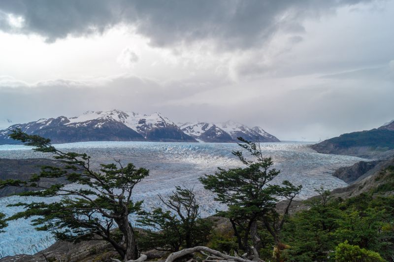
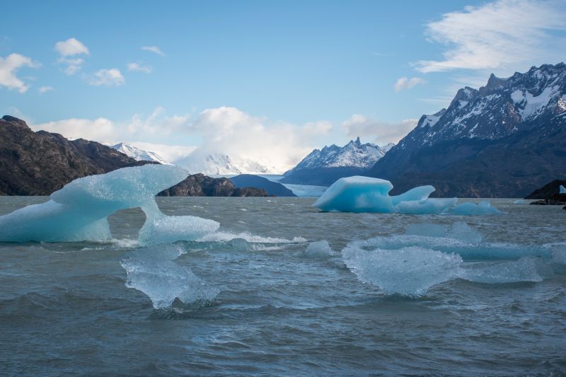
We cross the Pehoé Lake by catamaran to the Paine Grande refuge to cross one of the stretches of the W. Around the midpoint...
More details >GLACIAR GREY
-
Exploration Path
We cross the Pehoé Lake by catamaran to the Paine Grande refuge to cross one of the stretches of the W. Around the midpoint of the hike, we can see the Grey Glacier and the Southern Ice Fields. We continue walking to the beach of Grey Lake where we board a boat that brings us to the glacier and then leaves us on the other side of the lake. We walk along the beach and through a forest to the van.
*Browsing is subject to the availability of Explora's external operator and the weather.
*For safety reasons, this exploration is available only between the months of September and April.
538 m 1.765 ft
-516 m -1.693 ft
273 m 896 ft
29 m 95 ftElevation Profile
LAGO GREY
Bosque
-
Hike
-
Easy
-
Half-day
We leave by van for the Lake Grey sector. From there we begin our walk by crossing the Pingo River through a forest until reaching the lakeshore. We’ll walk along the beach with views of the Grey glacier and the ice floes that break off of it.
More details >LAGO GREY
-
Exploration Path
We leave by van for the Lake Grey sector. From there we begin our walk by crossing the Pingo River through a forest until reaching the lakeshore. We’ll walk along the beach with views of the Grey glacier and the ice floes that break off of it.
126 m 413 ft
-126 m -413 ft
82 m 269 ft
45 m 148 ftElevation Profile
FERRIER
Bosque
-
Hike
-
Expert
-
Half-day
We travel by van to the Grey Lake where we begin a demanding ascent during which we get views of the Lake...
More details >FERRIER
-
Exploration Path
We travel by van to the Grey Lake where we begin a demanding ascent during which we get views of the Lake and the huge ice mass of the South Ice Fields. We cross a forest and continue to the top with panoramic views of the Grey and Pehoé lakes. We descend and return by van.
612 m 2.008 ft
-612 m -2.008 ft
642 m 2.106 ft
56 m 184 ftElevation Profile
Cornisas
Encuentro
-
Hike
-
Advanced
-
Half-day
We walk towards the Paine River until we reach the cliffs that give name to this exploration. As we gain altitude...
More details >Cornisas

-
Exploration Path
We walk towards the Paine River until we reach the cliffs that give name to this exploration. As we gain altitude, we have panoramic views from different perspectives. We see the Paine River, Pehoé Lake and at the top, we can contemplate the Paine mountain range and the surrounding valleys.
414 m 1358 ft
-427 m -1401 ft
373 m 1.224 ft
28 m 92 ftElevation Profile
Mirador Condor
Encuentro
-
Hike
-
Moderate
-
Half-day
We leave the hotel, walking along the shore of Pehoé Lake. In the distance, we see a hill on the summit...
More details >Mirador Condor
-
Exploration Path
We leave the hotel, walking along the shore of Pehoé Lake. In the distance, we see a hill on the summit of which is the Condor lookout, our destination. On the way, we pass through lenga and ñirre forests. When we get to the top, we have a 360° view of the park. We descend down a rocky slope to the van.
253 m 830 ft
-232 m -761 ft
239 m 784 ft
45 m 148 ftElevation Profile
Pingo Chorrillo
Bosque
-
Hike
-
Moderate
-
Half-day
We travel by van to Grey Lake. From there, we walk along a path along the Pingo River through a forest of native trees...
More details >Pingo Chorrillo
-
Exploration Path
We travel by van to Grey Lake. From there, we walk along a path along the Pingo River through a forest of native trees. During this exploration, we can enjoy different views of the Paine massif and bird watching. The return is by the same path.
235 m 771 ft
-235 m -771 ft
105 m 344 ft
56 m 184 ftElevation Profile
SARMIENTO
Estepa
-
Hike
-
Easy
-
Half-day
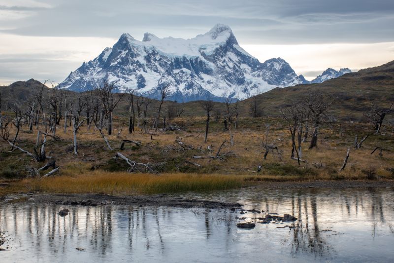
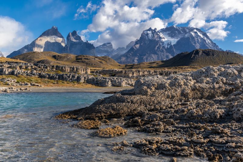
We will walk along a trail with low vegetation and views of the Paine Horns and Almirante Nieto. We then go down to the beach on the shores of Lake Sarmiento, where we will have the chance to walk among incredible calcium carbonate rock formations.
More details >SARMIENTO
-
Exploration Path
We will walk along a trail with low vegetation and views of the Paine Horns and Almirante Nieto. We then go down to the beach on the shores of Lake Sarmiento, where we will have the chance to walk among incredible calcium carbonate rock formations.
100 m 328 ft
-100 m -328 ft
125 m 410 ft
80 m 262 ftElevation Profile
-
Other options: